RELG 433 - Biblical Archaeology
Course Notes
Module 1 - Geography and Culture
Images in the text are linked to larger photos - click on them to see the larger pictures.
Hover the mouse over the images to see their captions and copyright credits.
Note on some terms for geographical features in the Middle East
A Tel or Tell is a flat-topped mound formed by the remains of a series of towns built one on top of another over a long period of settlement.
Nahal and Wadi are both translated in the Bible as "River", or in the Old Testament as "Brook". - In the Neolithic age there was probably more rainfall than now. The Romans caused the climate to become drier when they cut down the trees in Israel, around AD 70-150, as part of their destruction of the land during and after the Jewish revolts. In present times a Nahal or a Wadi is much like a "Wash" in the southwestern US - it's where the water runs when there's a rainstorm, which may not be more than a few times a year.
Har (Hebrew) or Jebel (Arabic) refers to a mountain or large hill. Har Megiddo (Armageddon) refers to the mountain of Megiddo. Jebel Musa refers to the "Mountain of Moses" (where Moses is presumed to have died).
A Kirbeth or Hurvah is a ruin visible on the surface of the ground, rather than something buried under layers of dirt. Kirbeth Qumran is the place near where the Dead Sea Scrolls were discovered.
An ayn or ein is a spring of water - usually coming out from underground between layers of rock on a hillside.
![]()
The geography of a region has a great influence on the way a culture develops in that area. The development of a culture depends on such features as rivers - the availability of water for drinking and crops, but also the likelihood of flooding; plains or mountains - ease or difficulty of transport and agriculture; and, as a culture develops, the ways in which settlements can be defended against invading enemies, and the availability of sea ports and land routes for trade with other peoples
For the general geography of the Mediterranean and the Middle East, see the Geography Pages
The regions which we shall consider are
- Egypt
-
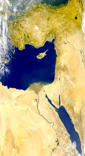 The River Nile, one of the longest rivers in the world, brings water to a narrow strip of land which is otherwise arid desert. The river is also one of the main means of transport within the country. There are no high mountains - the land is mostly low-lying (Lower Egypt) and flat, though Upper Egypt (to the south) becomes more mountainous, and there are cataracts in the river which made river transport more difficult. The waters of the Nile derive from melting snows far to the south, which result in heavy flooding, usually annually. Because of the necessity of being able to predict when the waters of the Nile would rise, and of developing means of control for the flood waters, the civilization which developed in Egypt depended on a priestly/scribal caste who could keep written records, and use them to predict times for the agricultural year. The field workers and farmers then had to co-operate and carry out their work at the proper times. This led to a strongly centralized form of government.
Egypt had no natural defences other than the desert, but that was sufficiently great and inhospitable to keep marauding peoples from invading the land. - Mesopotamia
-
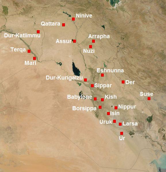
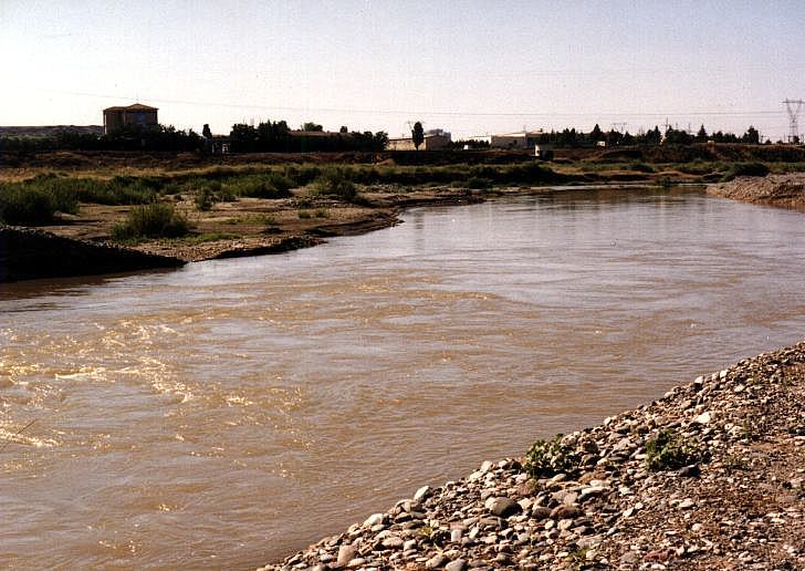
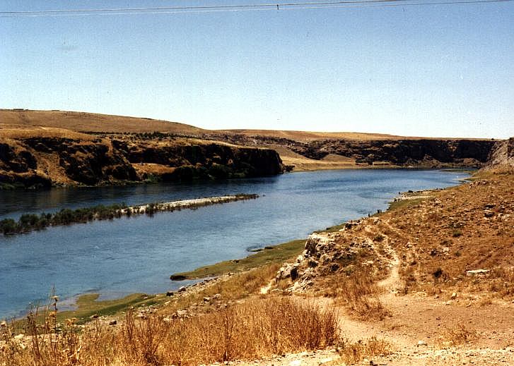 The name means "Between the Rivers". The rivers are the Tigris and the Euphrates, which rise in the mountainous region to the east of what is now Turkey, and flow through a wide valley until they combine and flow into the Persian Gulf. The northern parts of the region have mountains or steep hills to each side of the valley; towards the south the land becomes a salt marsh. The rivers have changed their channels several times over the centuries; although the rivers can be used for transport, the land was also suitable for the development of road systems. Irrigation expanded the area of land which could be used for agriculture, but there was not the necessity for predicting and controlling floods as was the case for Egypt.
 The first settlements probably developed on the hill-slopes to the east of the valley, and then spread into the valley. Individual settlements came into prominence in different places, and the civilizations which developed were of the "Local King/Priest of a City" type, some of which developed dynasties of rulers. In general, each city had its own god or goddess, its own temple, and its own ruler. There were frequent wars between cities, and war-lords would invade and burn each other's territory. As cities grew, writing was developed, to keep accounts for taxes and wages. There was also a wide-spread network of trade routes, as different regions needed resources which were only available from others.
 - Israel-Palestine
-
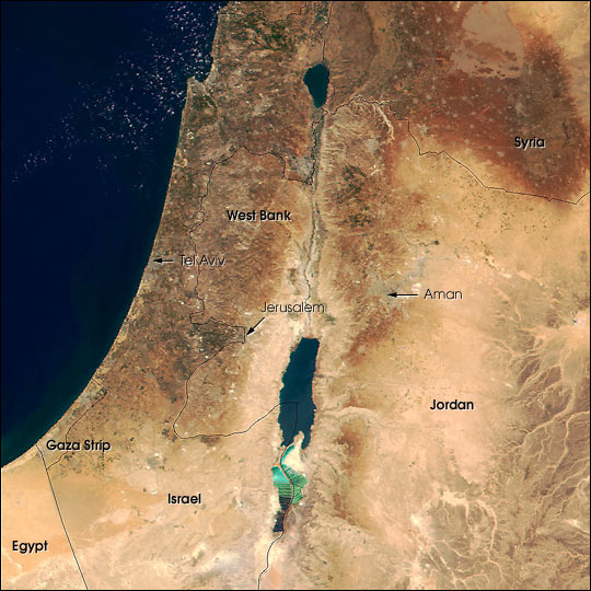 There have been several different names for this region, and most of the names have political overtones. For simplicity, these notes will usually refer to the region as Israel-Palestine, though Canaan, Philistia, Israel, Judea, Samaria, Hashemite Kingdom of Jordan, the West Bank (of the River Jordan), and the Gaza Strip are all names which are or have been used to refer to parts of the region at various times.
The region is dominated by a mountain spine of limestone, running roughly parallel to the coast of the Mediterranean. Limestone is soft and forms caves due to water dissolving the rock -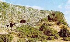 the caves around Carmel became home to one of the earliest groups of people in the region. The rain-water which percolated through the limestone made underground streams which flowed eastward until they came to the surface near the Jordan - limestone is so soft that men could dig through it with simple bronze tools, to dig wells for water supply for themselves and their animals.
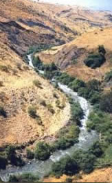
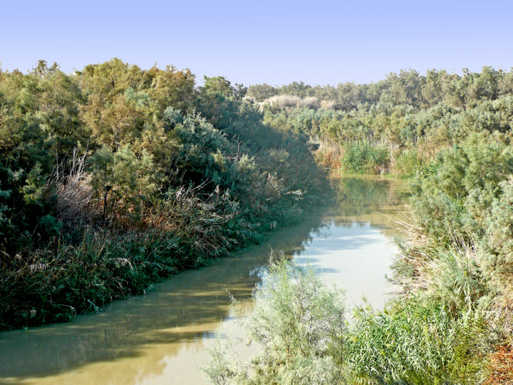 Between the mountains and the coast there is a coastal plain which became one of the main north-south routes for trade and military travel. To the east of the mountains, the River Jordan meanders through the northern extension of the Great Rift Valley, until it flows into the Dead Sea. This is the lowest place on earth; the Jordan does not flow into any of the oceans of the world - the water of the Dead Sea evaporates at such a rate that the flow of the Jordan is no longer sufficient to replenish it. The water-level of the Dead Sea is now sinking; so far as we know it has never connected south with the Gulf of Aqabar. The valley of the Jordan is relatively narrow, suitable for agriculture, but completely unsuitable for river-transport because of the many miles of winding bends.
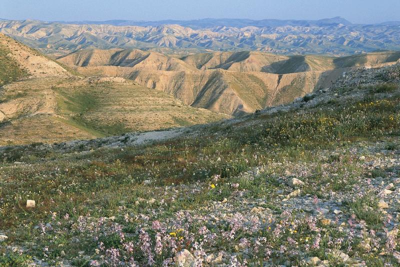 To the east of the Jordan valley rise more mountains, levelling off into regions of desert as the rainfall decreases due to the distance from the sea and the intervening mountains of Israel. There are no permanent rivers in this region, and the only peoples which this eastern desert can support are mainly nomadic.
The Mediterranean coast of Israel-Palestine has only one natural harbor - in the sheltered bay of Acre/Akko. The rest of the coastline consists of long golden beaches, made of sand which washes northward from the mouth of the River Nile - satellite photos show the plume of sand from the Nile spreading for miles into the Mediterranean. The harbor of Caesarea was built only after the Romans discovered how to make cement which would harden under sea-water. So, for most of the period which we shall be considering, there was very little maritime transport or trade.
To the south, the mountains continue into the Negev desert and the Sinai Peninsular.
To the north, north of Acre/Akko, the coastal plain shrinks to almost nothing, and the mountains come down to the sea. This northern coastland of what is now Syria gave rise to cultures dependent on the sea for their living. - Asia Minor
- This region is in what is now mainly Turkey. It is a very mountainous region, where the mountain chains which run generally north-west to south-east through Europe run into the mountains at the head of Mesopotamia. There are no good navigable rivers, and cross-country trade-routes and roads seem to have been late in developing. To the north-east was the region of the Steppes - grassy plains which early on became the home of wandering nomadic tribes who would sweep down and invade peoples to the south, and then carry their plunder back to their ranges. However, the mountains were a source of iron ore, so it was in this region that iron-working seems to have developed first, and the war-like Hittite Empire rose to power.
- Greece and the Islands of the Aegean
-
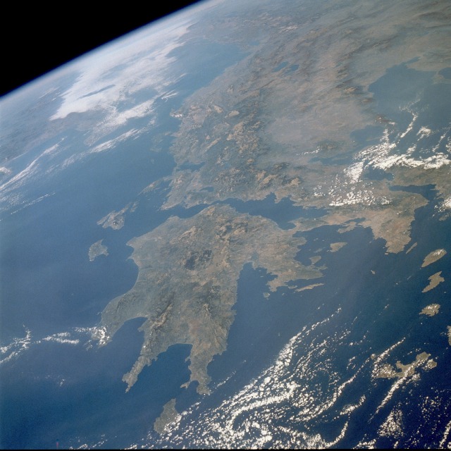 A look at the map of Greece will show that the mainland is what remains of the mountains, running generally north-west to south-east, which have become submerged by the Aegean Sea to the east. The mountains are steep, making travel between one valley and the next rather difficult. There are no good navigable rivers, but the coastline is such that there are many places suitable for harbors. To the east, the tops of the submerged mountains form many small islands in the Aegean. Consequently, this was a region in which sea-faring developed at an early time. The people were dependent on fish for much of their food, supplemented by what they could grow in the rocky soil - grapes, olives, grain. Because of the isolated nature of the valleys, and the difficulty of travel across the mountains, small towns and cities developed which were largely independent of one another. People tended to be independent also, and early in the history of this region most of the cities had developed forms of government which foreshadowed democracy. They were not truly democratic in the modern sense, because most of them depended on slave-labor, but an elite group of citizens shared in governing each individual city. So the mainland became a region of "City-States"
 - Italy and Rome
- A look at a map of the Mediterranean shows that Italy projects into the Mediterranean as a strip of land with one large mountain chain running generally north-west to south-east. Except for the north, which is blocked by the high mountains of the Alps, it is isolated from other land by the sea, so this was a region which was fairly secure from foreign invasion. Once a tribe or group of people had arrived, either by travel across the sea, or by infiltration through the mountain passes in the north, they would be able to settle relatively peaceably in some region. Hence, until Rome rose to power, the land was home to a variety of tribes who depended mainly on agriculture for their living. Their forms of government varied, but were mostly of the City-State or petty king type.
 Return to the Module
Copyright © 1999 Shirley J. Rollinson, all Rights Reserved