Geography Pages
Maps of the Roman Empire at the times of Trajan and Vespasian
All boundaries, and borders of countries, are approximate
The territory controlled by a king or people varied from time to time, and was often disputed by other peoples. An approximation to the modern coast-line is generally used in the maps.
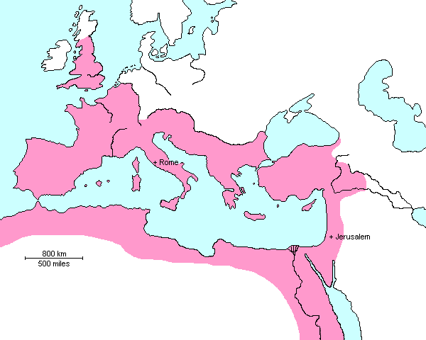
| The Roman Empire at the time of Vespasian - AD 70 |
|---|
 |
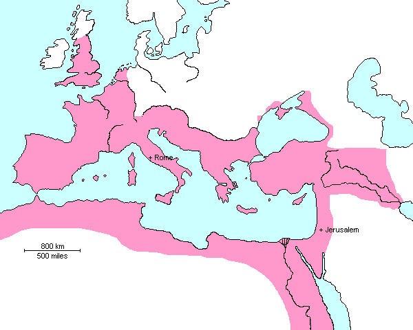
| The Roman Empire at the time of its greatest extent - Trajan - AD 117 |
|---|
 |
![]() Go here for the History of the period.
Go here for the History of the period.
Copyright © 1999 Shirley J. Rollinson, all Rights Reserved
![]()
![]()