RELG 433 - Biblical Archaeology
Notes - The Archaeological Dig
Images in the text are linked to larger photos - click on them to see the larger pictures.
Hover the mouse over the images to see their captions and copyright credits.
 Stratigraphy
Stratigraphy means the interpretation of the various layers or levels one encounters when digging through a site. One layer is a stratum, plural strata. Except for the site at Troy in Turkey, which was the earliest site to be excavated in any sort of logical order, the strata are numbered from the top (surface, ground level) down - stratum 1 is the surface of the dig, dating to the present day. During the progress of a dig, it may become evident that what was initially thought to be one occupation level can be differentiated into several, so one may find levels 6A, 6B, 6C, etc, derived from an original level 6.
The levels have been formed by settlement and occupation by people - they built houses and towns, lived in them for maybe several generations, and accumulated a layer of debris. Then the buildings were destroyed or fell into disrepair - fire, invasion by enemies, drought causing the population to move away - many factors could cause a change in occupation.
Succeeding occupations would rebuild or repair houses and towns, but would not clear all the previous debris away - they would generally smooth it over, and build on top of it.
This process, repeated over centuries, resulted in the distinctive form of the Tell - an artificial hill composed of layers of the remains of towns, one on top of another, with the most recent town on the flat top of the Tell.
Levels can sometimes be dated by dating finds associated with them, for example coins, particular types of glass or pottery. "Relative dating" is used for layers in which there are no datable finds - level 6, between level 5 and level 7, is later than 7 but earlier than 5.
 The Archaeological Dig
- Choice of a site, and Preparation for an archaeological expedition :
An archaeological dig is probably going to take several years of actual digging, and then a considerable amount of time to write up the report and publish it. The financial cost will be very high, and wealthy backers or government grants are usually necessary. For this reason the site must be chosen carefully - one does not just go and dig up some hill or other feature "just to see what's there". There are hundreds of unexcavated tels in the Levant - a wise director will choose a site that seems likely to give information about some of the unanswered questions about the peoples and cultures of the area.
Present-day place-names may give a clue as to the earlier name of the site; places where trade routes meet, or which command strategic positions, are likely to be favored over villages at the edge of the desert (unless one is making a special study of desert life-styles and survival techniques)
Aerial and Satellite photography and Infra-red Satellite photography may indicate features which are not obvious on the surface, and may indicate settlement patterns which are of interest.
Along with the choice of site, ownership of the land must be taken into account, and permits obtained from the national organization which regulates archaeological excavation in that country. Other factors are ease of access to the site, safety considerations, and the political situation in the Middle East. - Rescue Digs are digs which are not planned in advance, but which are called for when other construction activities, such as roads, parking lots, or new buildings, indicate that there are archaeological remains at that location. In such cases construction is often halted for a few weeks while a team of archaeologists is sent in to recover whatever information and artefacts they can find before construction resumes.
- Before commencing to dig into the ground, a thorough surface examination needs to be made by several methods. Aerial photography can reveal depressions and ridges in the ground which may indicate traces of roads, buildings, or other structures underground. Such photos taken in the very early morning or late evening, when shadows are long, give the best detail. Differences in the color of crops from one part of a field to another may indicate the presence of more organic material, such as wood, under the ground. Sonic detectors are often used, to detect cavities and differences in the density of the ground - this can show buried walls and parts of buildings.
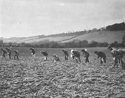
 A Field Survey involves lining up all the dig workers and having them walk slowly across the area to be investigated, examining each part of the surface in detail for surface finds.
Then a more detailed examination may be made by kneeling on the ground and sieving the surface dirt for any fragments of anything that may be found - amongst the cigarette butts and coke caps. - A Dig will have one person as the main Dig Director, whose word is Law. The Director will have had to get the necessary permits for the Dig - paperwork varies from one country to another. The Director decides where excavation will take place, and who will be responsible for what on the team.
There will be a group of Supervisors, appointed by the Director. Each supervisor is in charge of a particular area of the dig, and oversees a team of several students, volunteers, and maybe some paid local workers, who do the hands-on dirt work.
Essential on all digs is the "Potting Tent" or Shed, where pieces of broken pottery are recorded, cleaned, and matched up with other pieces if possible. Other essential jobs are Surveying, Record keeping - what is found where, Sketching, and Photography - of finds and of the dig in progress, showing the strata.
Depending on the dig, other experts may be called upon - to analyse pollen, to perform radiocarbon dating, to decipher and date inscriptions (epigraphy), to perform chemical analysis of residues found in vessels or of the patina on metal or stone objects, or medical and pathological examination of bones to find the probable cause of death and general state of health of the person or animal at the time of death. -
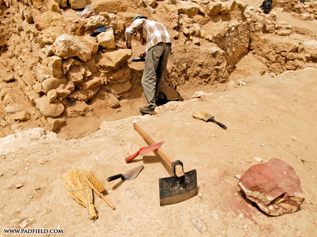
Tools used on a dig - Forget the pickaxe and the shovel !
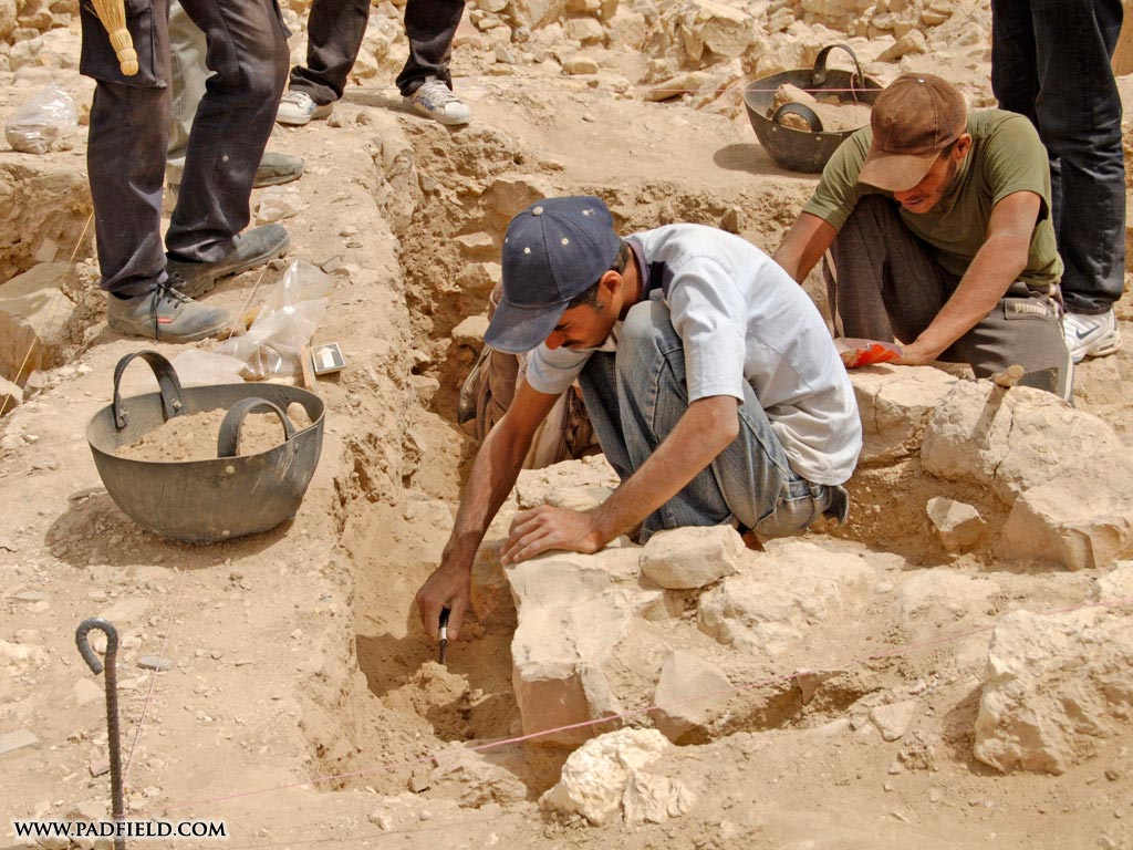
 The main implements you would use on a dig are the paint brush and trowel, and the dirt bucket. Paint brushes of various sizes are used for brushing dirt away from objects or from between stones - very gently, and watching constantly for artefacts or anything unusual. A trowel is used, also very gently, to loosen the dirt so that it may be inspected, sieved, and carted away.
 Dirt buckets are made of thick rubber (often recycled auto tires), hold several gallons, so are quite heavy when full. You would be expected to carry them, or be part of a bucket-chain, to the sieving area - and keep doing that in hot dry sun - the climate in Israel is like that in New Mexico. Some digs use different buckets for pottery, bones, dirt, etc.
Other equipment would be sieves for the dirt, sandbags for putting on the sides of an excavated portion to stabilize it, surveying equipment, and yardsticks for measuring and for including in photos to show the scale of something.
The pickaxe is used only on the express orders of the Dig Director - and then only by one or two trusted workers at a time. It is used to get through surface layers of concrete, or to break up hard-packed dirt. I was on a dig in London, in which one of the guys got impatient with troweling through hard dirt and decided to whack it with the pickaxe - and put the point through what would have been the only intact vase of Samian Ware in Britain. - Finds : There are two main categories of finds - Organic (from organisms which were alive), and Inorganic
Organic remains include
Wood (used in buildings or as handles of implements, the remains of fruit trees, or as fuel). Wood also produces layers of ash when large quantities are burnt, as when a city or house is set on fire. The date at which the trees for the wood were cut can be obtained by Carbon14 dating.
Seeds can be identified by a paleobotanist or archaeobotanist, and will give information as to diet and agriculture.
Bones - Human bones can give information as to the age and sex of a person, and what illnesses or other conditions were prevalent. Animal bones show what animals were kept or hunted, whether the animals were domesticated or wild, and if they were butchered as part of the diet.
Inorganic remains or artifacts include
Walls and buildings - for these one must consider their size, probable function, and relative chronology
Pottery is invaluable for working out the chronology of the site and the probable culture(s)
Writing includes inscriptions, ostraca (messages, lists etc. written on pieces of pottery), papyrus (particularly in the dry conditions of Egypt). The study of the way in which writing changed through the years, the way in which the shapes of the letters changed, the various changes in materials used, is called Epigraphy.
Metals (gold, silver, copper, bronze, iron, and alloys of these metals) - one must consider the type of object and its probable use - ritual? household? hunting? farming? war? Also what were the probable sources of the ores for the metals, and by what trade routes did they reach the site. Coins give information as to the date, and to the wealth of the culture.
Stone artefacts include carvings, statues, inscriptions, seals. They may indicate what or whom they commemorate, or they may be a silent mystery which the archaeologist seeks to understand.
![]()
 Back to the Module
Copyright © 1999 Shirley J. Rollinson, all Rights Reserved