REL 433 - Biblical Archaeology
Course Notes and Photos
Modules 10, 11, & 12
Iron Age IIA, The United Monarchy, ca. 1,000-925 BC
Iron Age IIB, The Divided Monarchy, 925-722 BC
Iron Age IIC, Judah alone, 722-587 BC
Images in the text are linked to larger photos - click on them to see the larger pictures.
Hover the mouse over the images to see their captions and copyright credits.
Seals and bullae
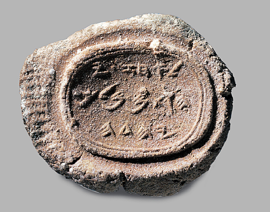
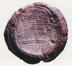
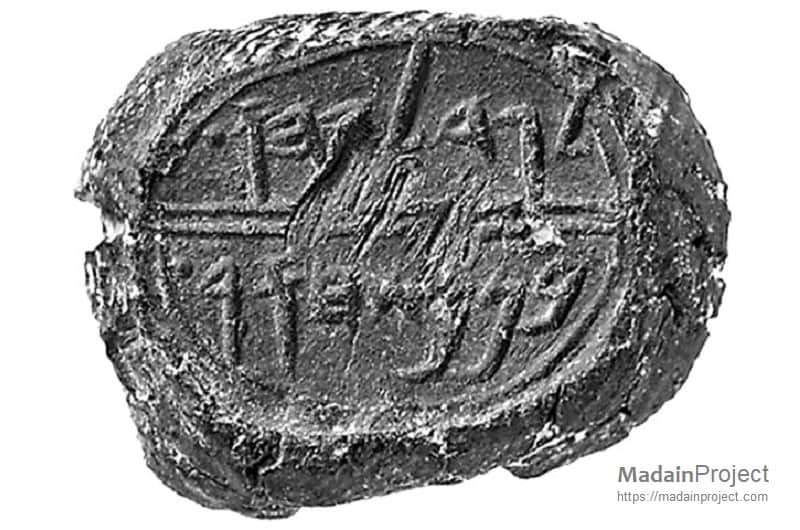
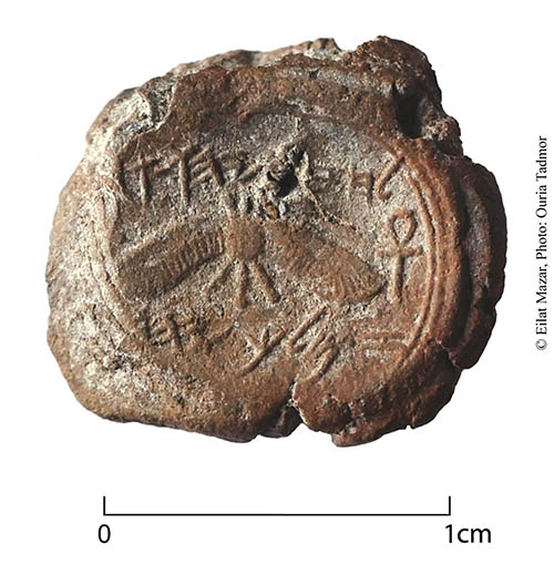
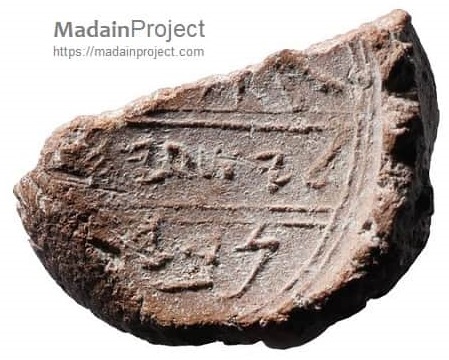
Seals were in widespread use throughout the Levant in ancient times. They were used for securing documents - a small lump of clay would be pressed onto the cords holding the document, and the seal would be pressed into the clay, leaving its impression in the clay. The dried button of clay with the impression of the seal is known as a bulla.
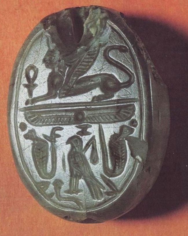 |
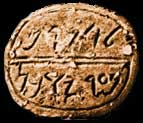 |
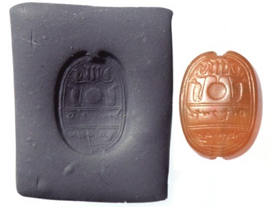 |
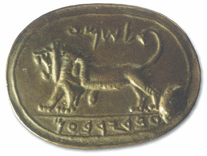 |
| Jezebel | Eliakim | Ushha, servant of Ahaz | Shema |
 |
 |
 |
 |
 |
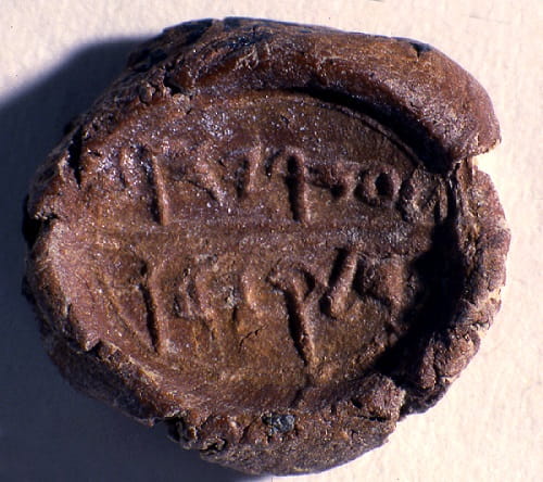 |
| Ahaz | Baruch | Gedaliah | Hezekiah | Isaiah ? | Azariah |
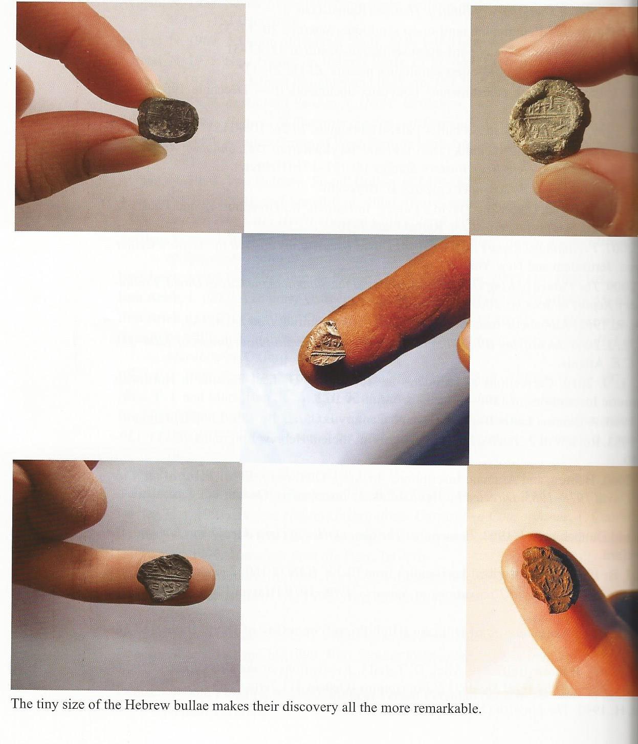 Bullae are usually quite small - even about the size of a finger-nail; they are often found by "wet-sifting" the dirt from a dig. Several bullae with names of Israelite kings or other Biblical people have been found. Although one cannot say with certainty that the impressions were actually made by particular kings, it is most probable that they were at least used by an official acting on behalf of a king. Though seals and bullae may not prove the existence of a particular person, they do indicate that particular personal names were in use during their find-period.
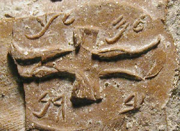
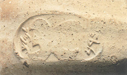 Another use of stamp-seals was the "lemelech" stamp used on pottery. Hebrew melech means "king", and the prefix "le" indicates possession or relation - "belonging to the king", "for the king", "about the king ". So jars stamped with a lemelech stamp probably contained provisions for the royal household. Many pieces of pottery with lemelech seals have been found.
Water systems
The mountain spine of Israel is limestone - rain will soak through the rock and form underground streams, and will also dissolve the rock slowly, forming tunnels and channels. From earliest times settlements were founded where there was a supply of water. Through the centuries, as the settlement grew, and successive layers started to form the tell, the city was built on top of the tell, but the water supply remained at a lower level, often emerging as a spring outside the city walls (Megiddo, Jericho). People would go out of the city to get their water - as was still the case at Sychar at the time of Jesus (John 4:5-8), though in that case the water-supply was a very deep well dug down to the level of the water - which is still flowing underground even today. In the case of Jericho, the spring still flows out of the side of the tell, and is still used as a supply of drinking and irrigation water by the people of modern Jericho (which is built to the east of the great tel).
With the development of city-states in the Bronze Age, and the likelihood of attack and siege, it was necessary to secure the water-supply, so initial tunnels were built from inside the city to reach the water. Later, during the Iron Age, and the invasions of foreign powers, it was necessary to conceal the original spring and to extend the tunnel system below the city (Jerusalem, Megiddo).
Cities and Settlements
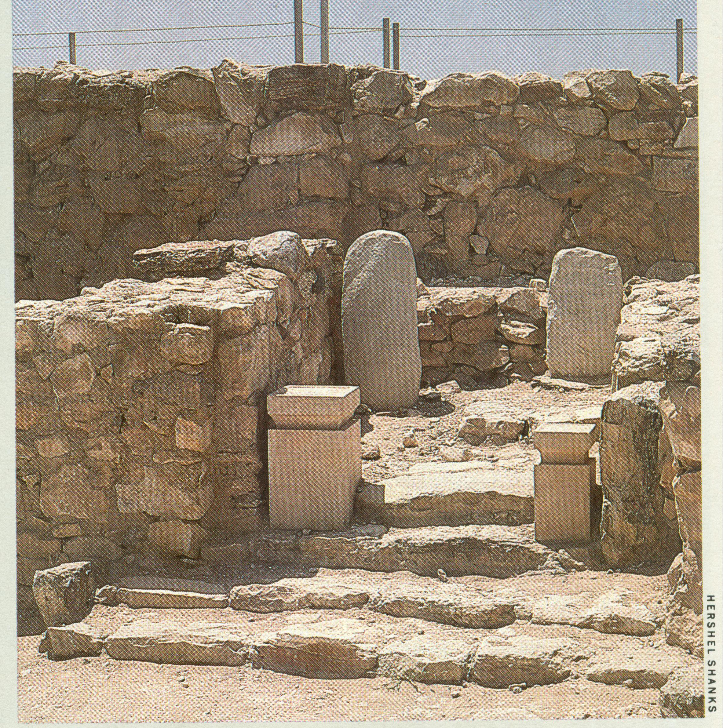
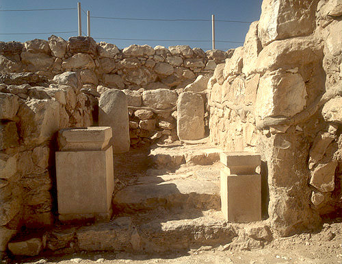
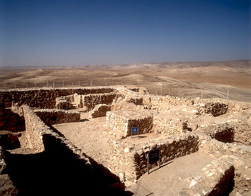
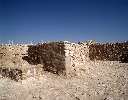 At Arad in the northern Negev the kings of Judah established a fortress and a central supply and military stronghold to guard their southern border and the road to Moab and Edom. The original excavator, A. Aharoni, dated the initial fortress to the time of Solomon, with further alterations and rebuilding, perhaps during the time of Uzziah. This fortress contained a small "Temple" and an altar built of field stones in the courtyard of the Temple. Ostraca found throughout the site help in the dating of the various layers. It appears that it was a stronghold against attacks by the Edomites, and that it fell to the Edomites some time after Sennacherib invaded Judah.
Beer-Sheba
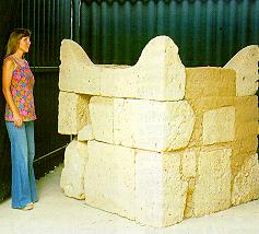
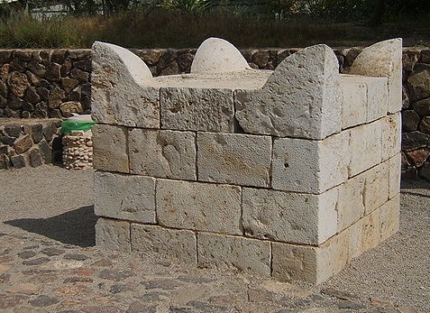
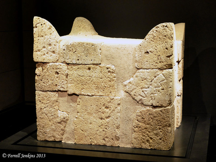
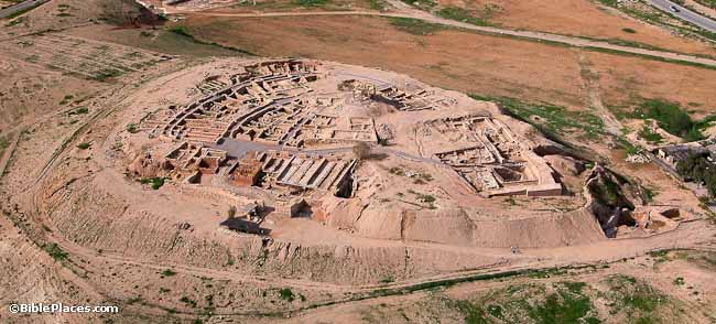
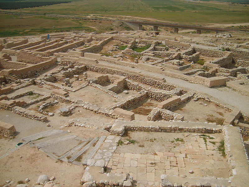
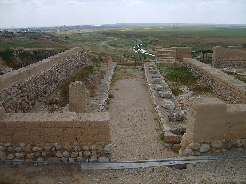
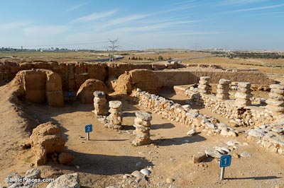 At Beer-Sheba there is the Biblical record for a cult center during the Divided monarchy (Amos 5:5, 8:14, II Kings 23:8). The remains of a large altar were found by Aharoni. The stones of the altar were found in secondary usage, but have been re-assembled for modern display. A four-room-house and a (reconstructed) storehouse are also on view at the site.
Dan
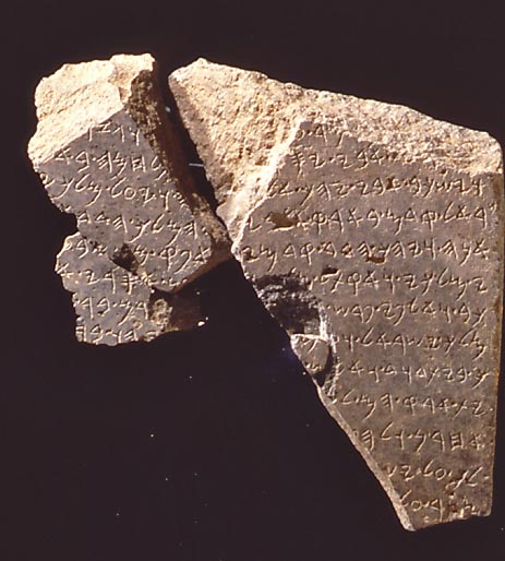
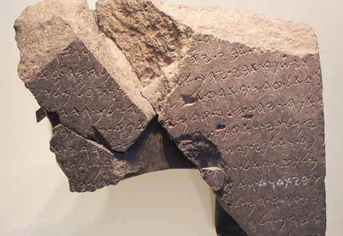
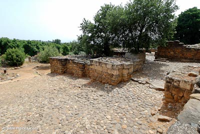 At Tel Dan there are not only the remains of a large Iron Age gate, but also an inscription in paleo-Hebrew, mentioning the "House of David" - one of the earliest non-Biblical references to David.
Gezer
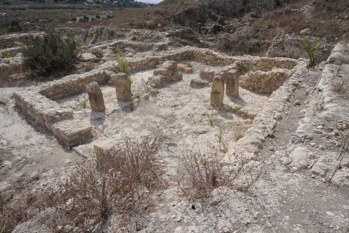
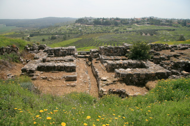
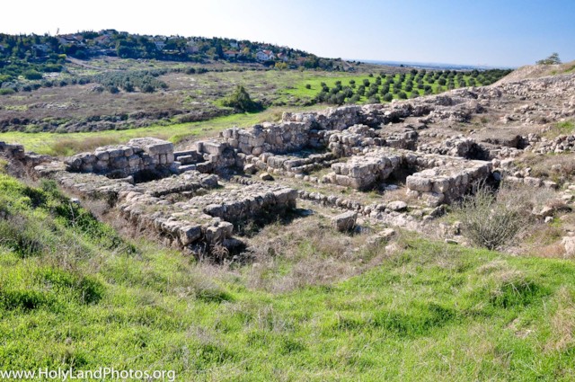
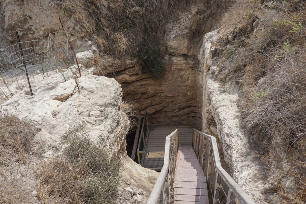
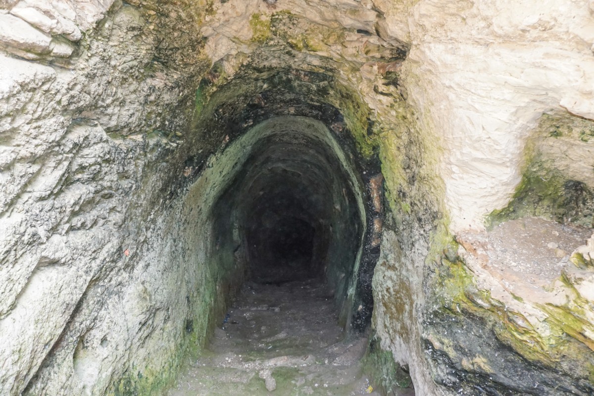
At Gezer the remains of the solomonic city gate, a four-room Israelite house, and an extensive water-tunnel have been excavated.
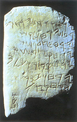 The Gezer Calendar was found in 1908 By R. A. Stewart Macalister of the Palestine Exploration Fund. It was claimed by the Ottoman Empire, and is at present in the Turkish Archaeology Museum. It is a limestone block with a short inscription listing the agricultural work to be done during the year. It reads :
Two months gathering
Two months planting
Two months sowing
One month cutting flax
One month reaping barley
One month reaping and measuring grain
Two months pruning
One month summer fruit.
Abi . .
"Abi . ." (broken off) was probably the name of the scribe, maybe the common Israelite name Abijah.
Hazor

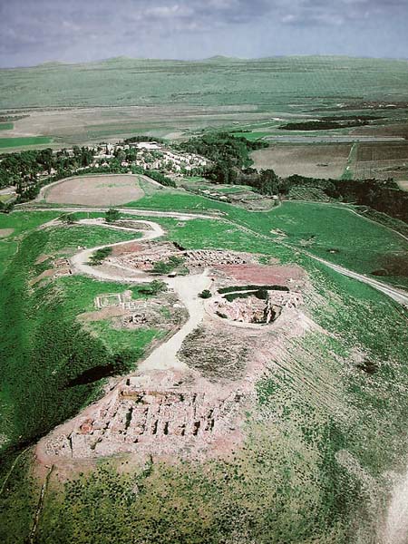
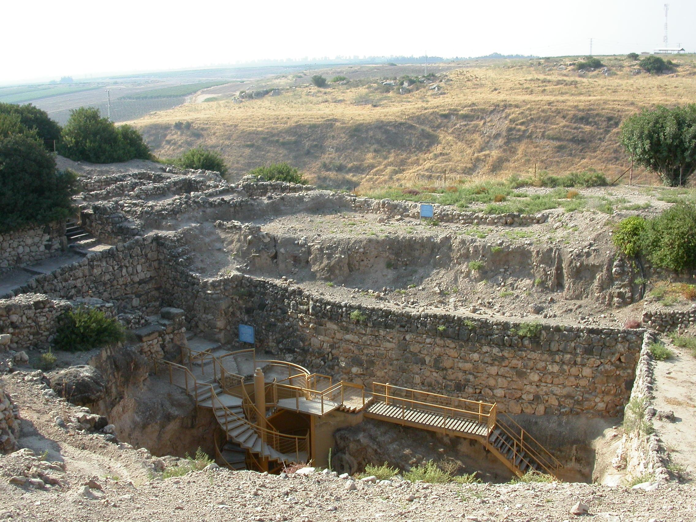
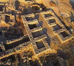
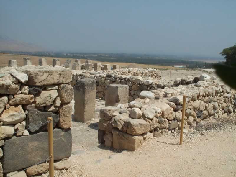
Hazor is probably the largest tel and one of the largest archaeological sites in Israel. The Iron Age discoveries include the six-chambered City Gate, an Israelite four-room house, and the Water Supply.
Jerusalem
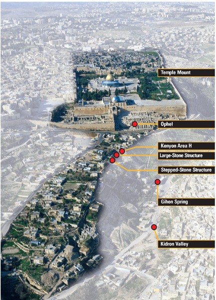
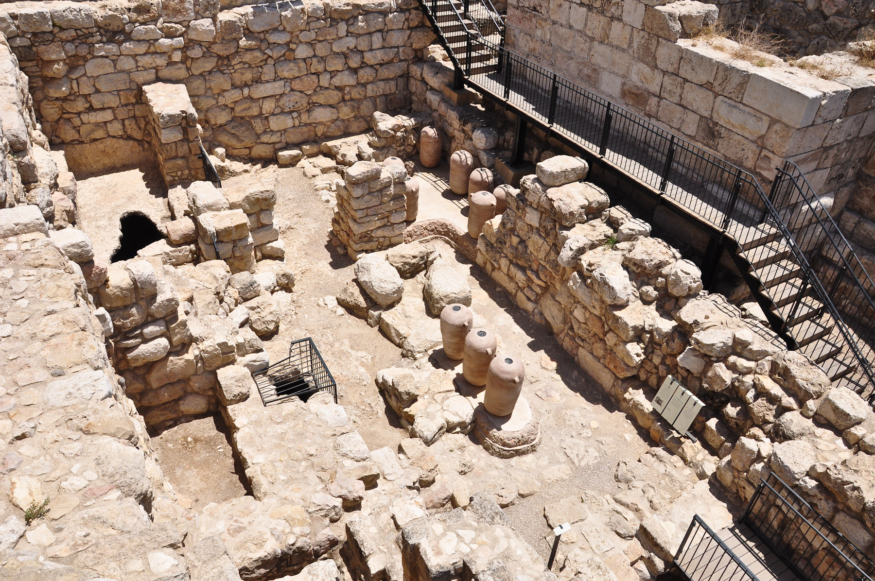
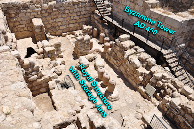
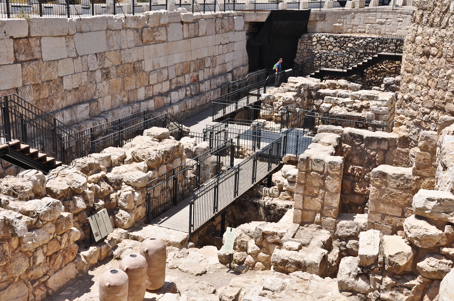
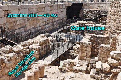
The remains of Iron Age Jerusalem lie beneath the central part of the present city, so opportunities for excavation are rare.
To clear the way for archaeological exploration often involves the eviction of families from homes in which they have lived for years. However, tourism is one of the main industries of the State of Israel, and visits to archaeological sites are one of the highlights of the tourist industry, so a limited amount of excavation is taking place.
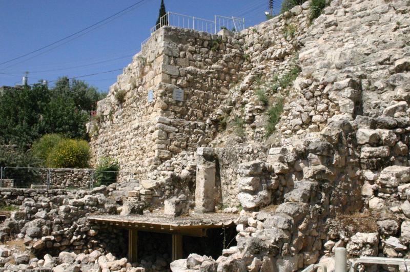
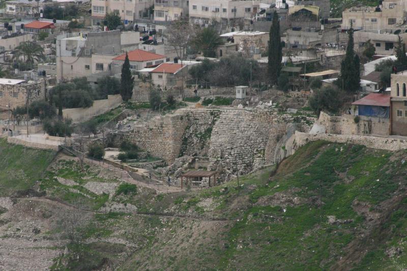
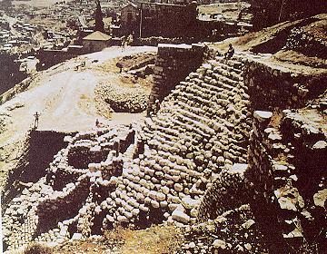
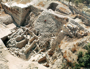 A prominent feature of the archaeology of Jerusalem is "the stepped-stone-structure" - a large steep stone slope to the south of the Temple Mount. It is believed to have been part of the earliest defensive system of the city, probably topped by the city wall.
Dating to a later time is the "House of Ahiel" (so called because the name of Ahiel was found inside the house) which was built into the slope and has been retained in the present excavation.
Lying beneath and behind the stepped stone structure is the water system - parts of which date back to the time the city was occupied by the Jebusites. During the time of the United Monarchy one of the sources of water was the Gihon Spring (I Kings 1:31-34, 38-39) which lay outside the city walls.
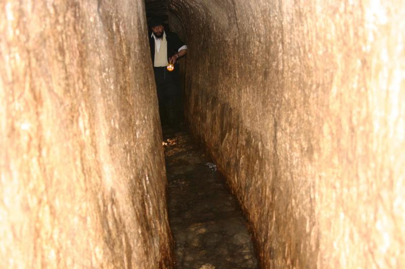
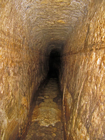
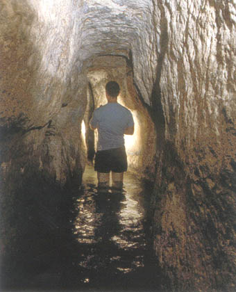 When King Hezekiah was expecting an invasion and siege by the Assyrians he organized crews of workers to hide the Gihon Spring and dig a tunnel to bring the stream underground under the city (II Kings 20:20, II Chron.32:2-4, 30). The crews went at it from both ends, and the place where they met was marked by a commemorative plaque recounting how they had followed the sound of one another's picks. The water-tunnel was rediscovered by Edwin Robinson in 1838. During the time of the Ottoman Empire, the inscription was chiseled out of the rock, and ended up in the Istanbul Museum - it is known as the Siloam Inscription.
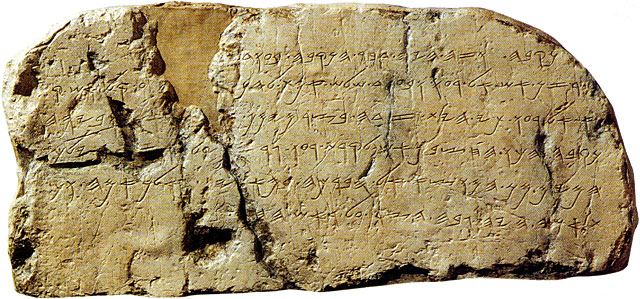
'And this was the way in which it was cut through: While . . . still . . . axes, each man toward his fellow, and while there were still three cubits to be cut through, . . . the voice of a man calling to his fellow, for there was an overlap in the rock on the right . . . And when the tunnel was driven through, the quarrymen hewed . . . each man towards his fellow, axe against axe; and the water flowed from the spring toward the reservoir for 1,200 cubits, and the height of the rock above the heads of the quarrymen was a hundred cubits.'
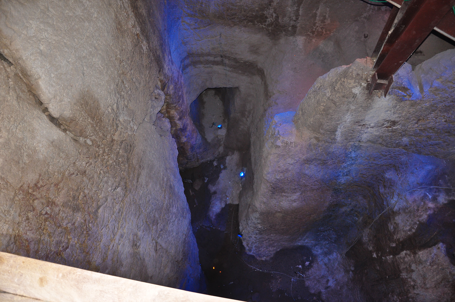
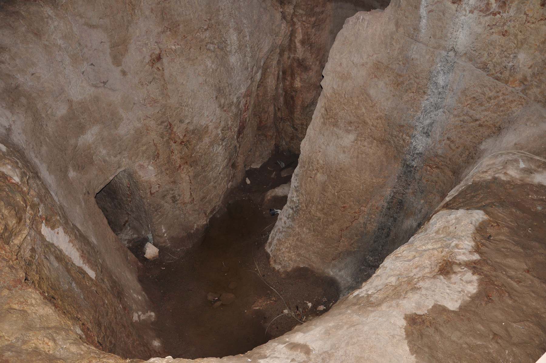 In addition to the tunnel for the flow of water, there are also vertical shafts and tunnels which were used for drawing water up to the surface. Until recently it was thought that David's general Joab captured the Jebusite stronghold by climbing up the water-shaft (I Chron. 11:4-7). However, this is now regarded as doubtful. The water-system is very hard to date with certainty - it has been modified and extended through the centuries. One may still walk through the length of the main tunnel - there is a steady flow of cold clear water, reaching about to the knees, with loose pebbles underfoot, with the only lighting being from a torch or candle; it takes over half-an-hour to walk the length of the tunnel.
Other sources of water for the city were the large cisterns for collecting and storing water. The rock on which Jerusalem is built is limestone - it has been eroded by rainwater, forming large underground caverns which were used as cisterns. Some of these lie beneath the Temple Mount so are generally inaccessible because of the political and religious sensitivity of the area.
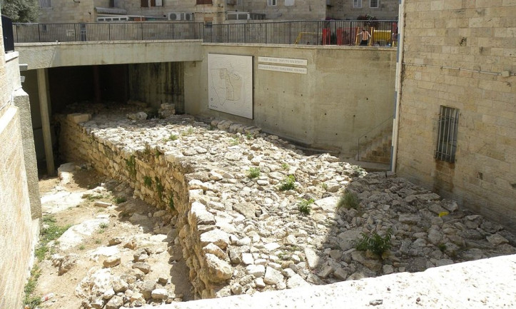
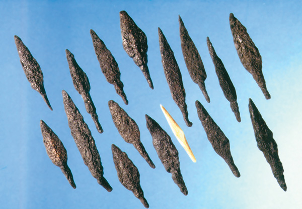
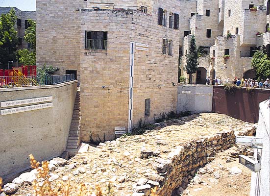 Another measure which Hezekiah took against the Assyrians was to extend and strengthen the walls of Jerusalem. Parts of Hezekiah's wall, known as the Broad Wall, have been excavated to the north of the Temple Mount. That they were part of the defenses against the Assyrians was shown by the discovery of Assyrian arrows in the walls.
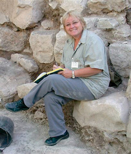
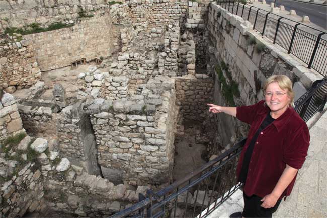
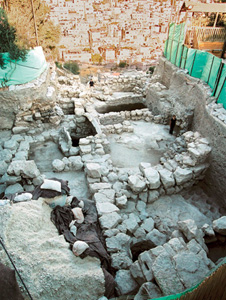
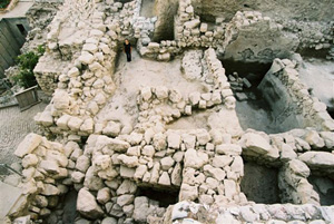 One of the archaeologists working in Jerusalem at present is Eilat Mazar, the niece of Amihai Mazar. She has discovered what she hopes may be the remains of King David's palace (which at present she refers to as "the Large Stone Structure") near the stepped-stone-structure, as well as parts of the defensive wall and related structures from the time of the United Monarchy.
Lachish
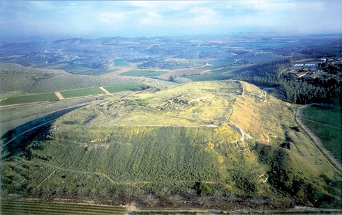
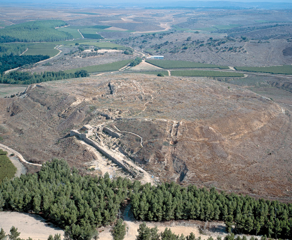
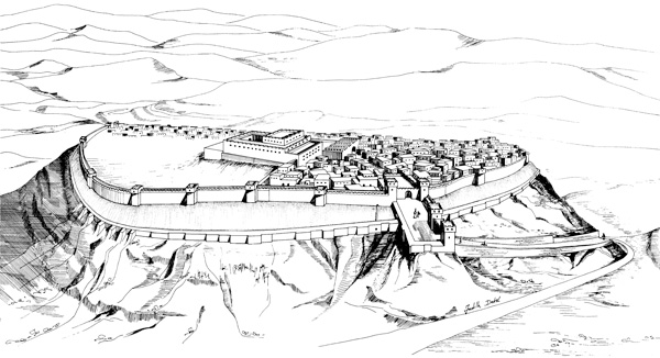 Lachish, one of the major cities of Judah, was first excavated (1932-1938) by James Starkey, but the dig came to a sudden end when Starkey was murdered by bandits in 1938.
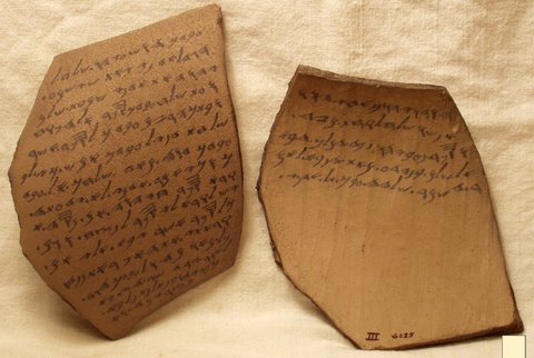
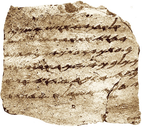
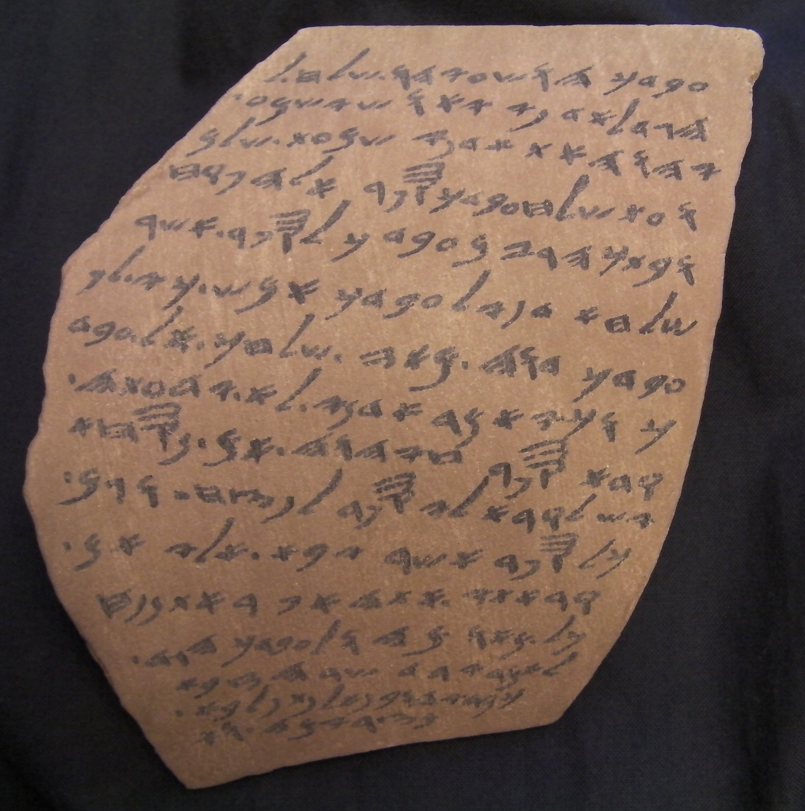
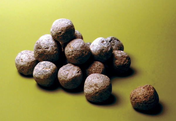
Starkey uncovered the Assyrian siege ramp, dating to the siege by Sennacherib, and a mass burial of 1,500 people in a nearby cave.
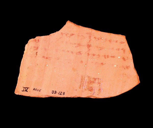
In a guard-room in the city gate Starkey discovered 18 ostraca with messages to and from the military garrison, during the last days before the fall of Lachish to Nebuchadnezzar and the Babylonians. Lachish ostracon IV states "We are watching for the beacons of Lachish . . we cannot see . . . Azekah". Jeremiah 34:7 reports that Lachish and Azekah were the last two cities besides Jerusalem to hold out against Nebuchadnezzar before the Babylonians finally conquered Judah.
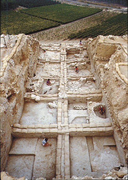 During the 1960s Yohanan Aharoni led a small expedition to the tel, then from 1973 to 1987 David Ussishkin led the excavation, concentrating on the Late Bronze and Iron Ages, and working on the city gate complex. Ussishkin has intentionally left some areas only partially excavated, so that future archaeologists will have undisturbed areas to work on with more advanced techniques.
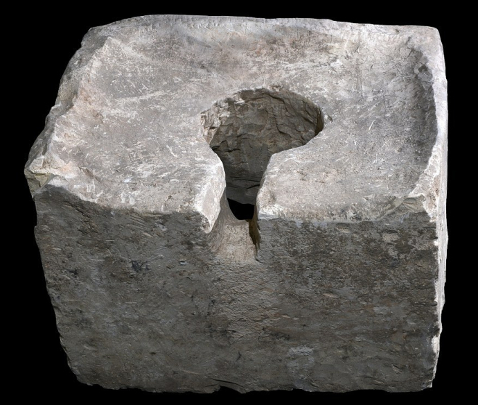 At Lachish the archaeologists found a cultic site within the city gate, which they dated to the eighth century BC. Two altars had been broken up, suggesting the reforms of Hezekiah (II Kings 18:1-4), and the cultic place had been defiled by turning it into a toilet.
During Hezekiah's reign Sennacherib and the Assyrians invaded Judah and captured Lachish (II Kings 18:13-17; ca. 701 BC) - the Assyrian siege ramp is still a prominent feature of the tel.

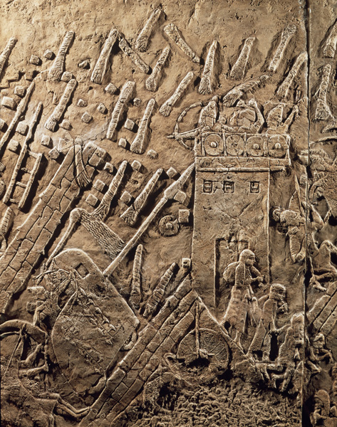 Sennacherib recorded the progress of the siege in a series of wall reliefs in his palace at Nineveh - a battering ram pounded the walls, defenders fell from the walls and tower, and captives were marched off or killed by being impaled or flayed alive.
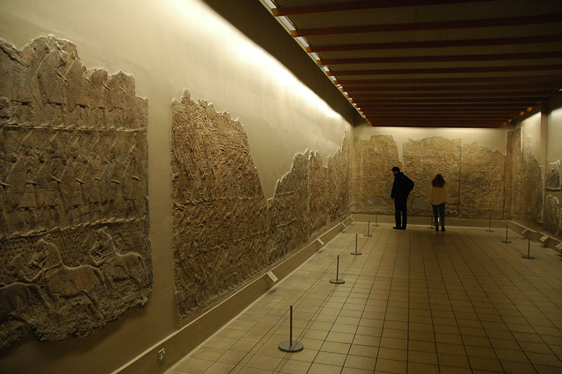 The wall reliefs had been discovered at Nineveh by Austen Layard from 1847 to 1851, and are now displayed in their own room in the British Museum.
Hezekiah managed to buy Sennacherib off, and it appears that Lachish was returned to Judah again for a short while. However, when Nebuchadnezzar invaded Judah during the reign of King Zedekiah, Lachish came under attack again. Lachish and Jerusalem both fell, and the Babylonian captivity of the Jews began.
Megiddo
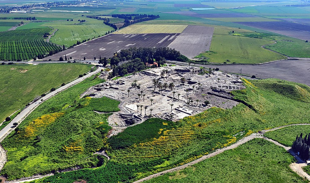
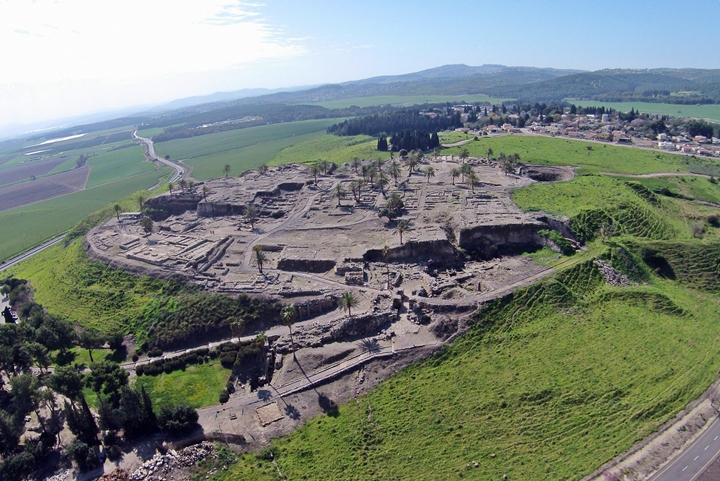
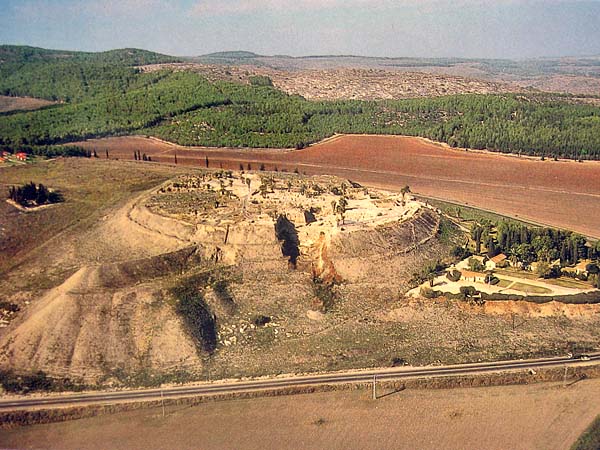 Although it was never a capital city, Megiddo was one of the richest and most powerful of the northern cities of Israel, commanding the valley of Jezreel, which is strategically important as the route from the Mediterranean coast to Syria, Damascus, and the East. Megiddo was one of Solomon's chariot-cities (I Kings 9:15, 19)
The tel is large and high, and has been the site of several major excavations, one of which is still in progress.
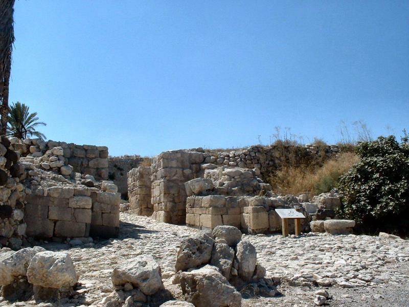
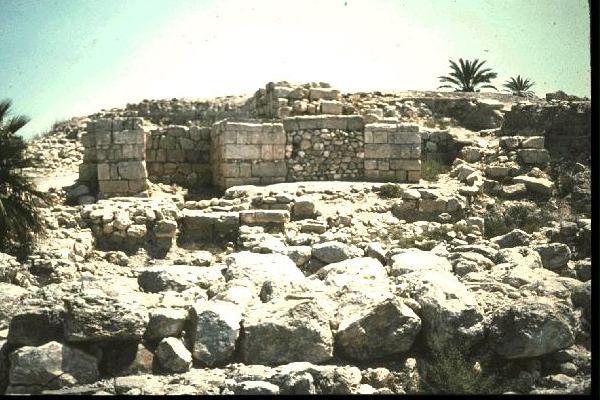 Features relating to the Iron Age are the gate complex, dating to the time of Solomon,
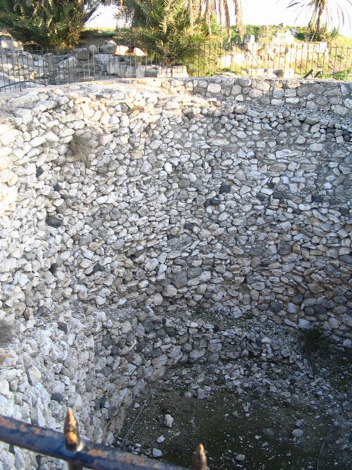
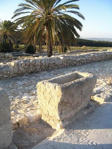
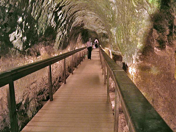 an extensive water tunnel, a large storage silo or pit, and the remains of a building which is commonly known as "Solomon's stables" because of the stone troughs which stood in rows there. Whether they are really feeding troughs for horses is debatable - some say that they are much too close to one another to have been used for stallions, and that the stables were probably outside the city itself. To my mind, the troughs seem more suitable for washing vegetables, and there surely must have been a large kitchen attached to the palace. Also, it would make more sense to have a large number of chariots kept mobile outside a city than inside it. The city gate would form a bottle-neck, chariots could only go through it one at a time. To drive a chariot through the confines of a city gate would be tricky and not helpful to a quick attack on an enemy.
Samaria
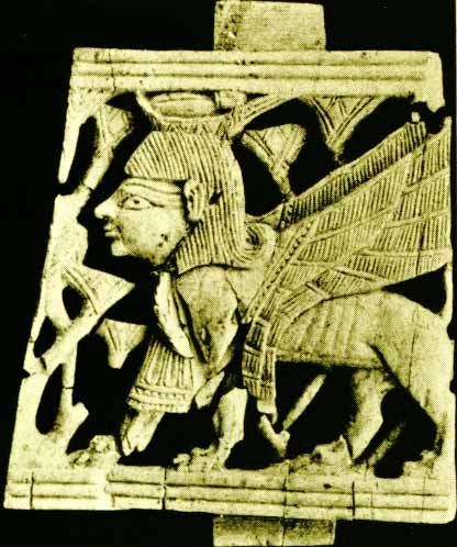 Samaria became the capital of the Northern Kingdom during the reign of Omri (I Kings 16:23-24, ca.876-869 BC). It is noteworthy for the collection of carved ivory inlays which were found in the palace building, and for a trove of ostraca which recorded the supplies for the palace.
![]() Back to Module 10
Back to Module 10
![]() Back to Module 11
Back to Module 11
![]() Back to Module 12
Back to Module 12
![]()
Copyright © 2020, Shirley J. Rollinson, all Rights Reserved